OVERLANDER
COCKPIT

Map, attitude and weather for the road – even without signal.
Overlander Cockpit shows on one screen where you are, how much your vehicle is tilting, what the weather will do and what is worth seeing nearby. For iPhone and iPad. Downloaded maps work offline too.
14 days fully unlocked, no account
- iPhone & iPad
- iOS 18 or later
- Offline maps for all of Europe
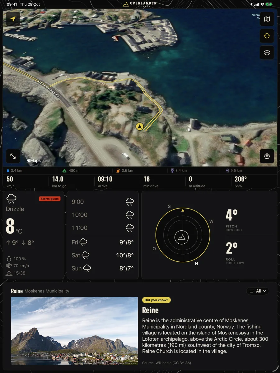
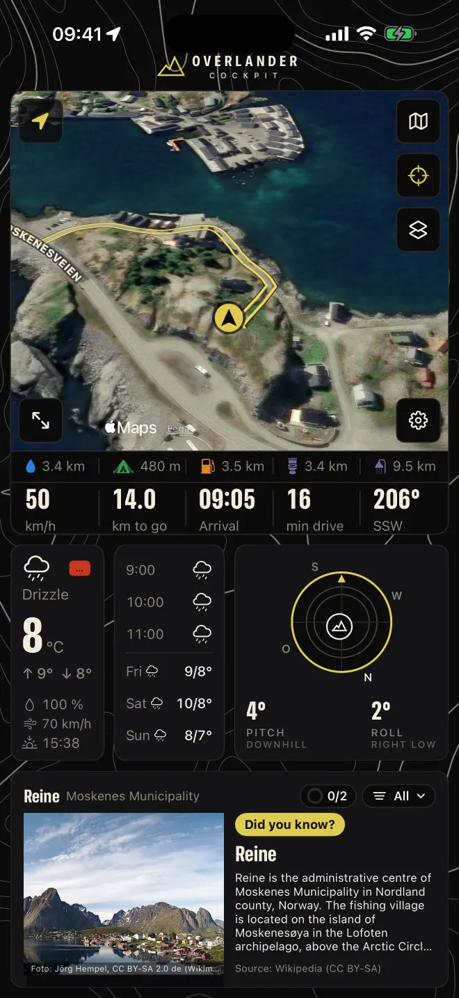
Weather and more right on the map.
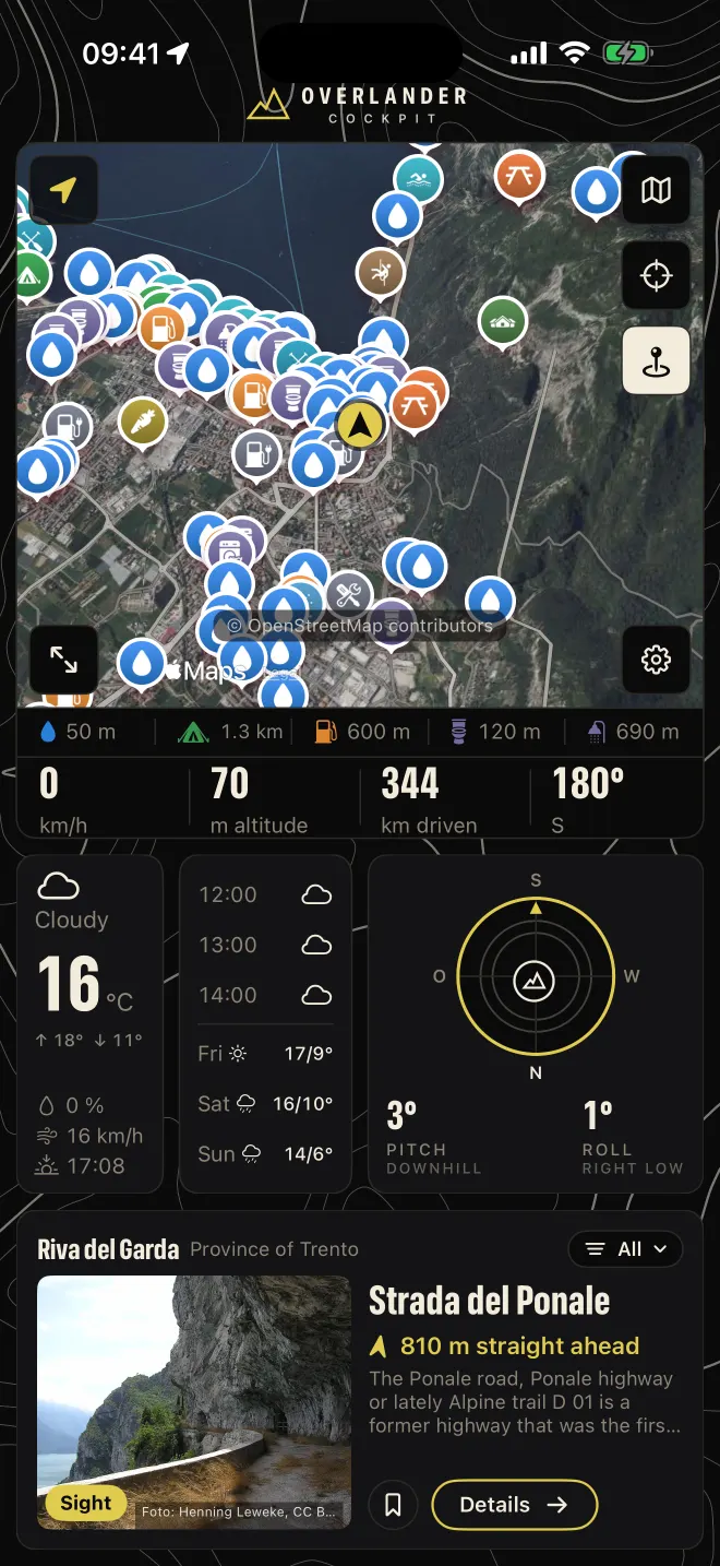
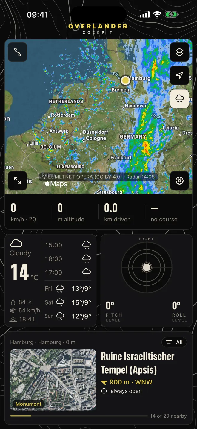
Places, rain, wind, temperature and drone zones go straight over the map.
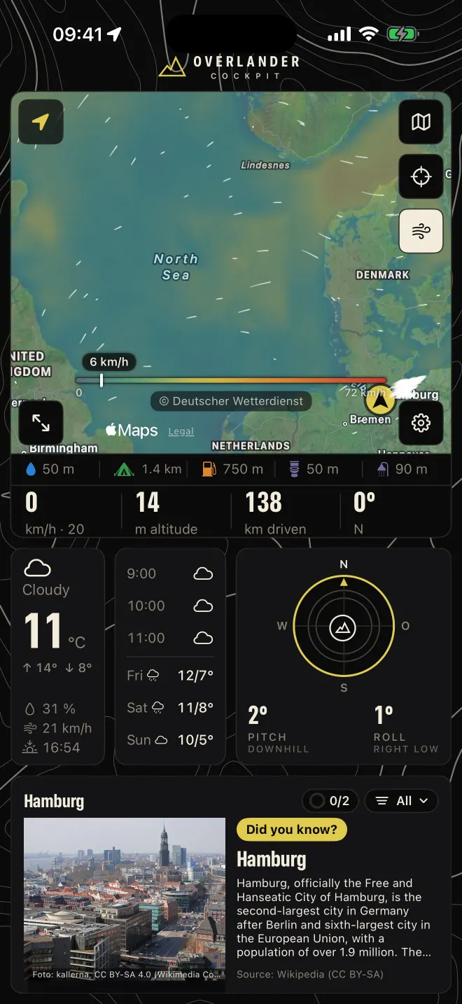
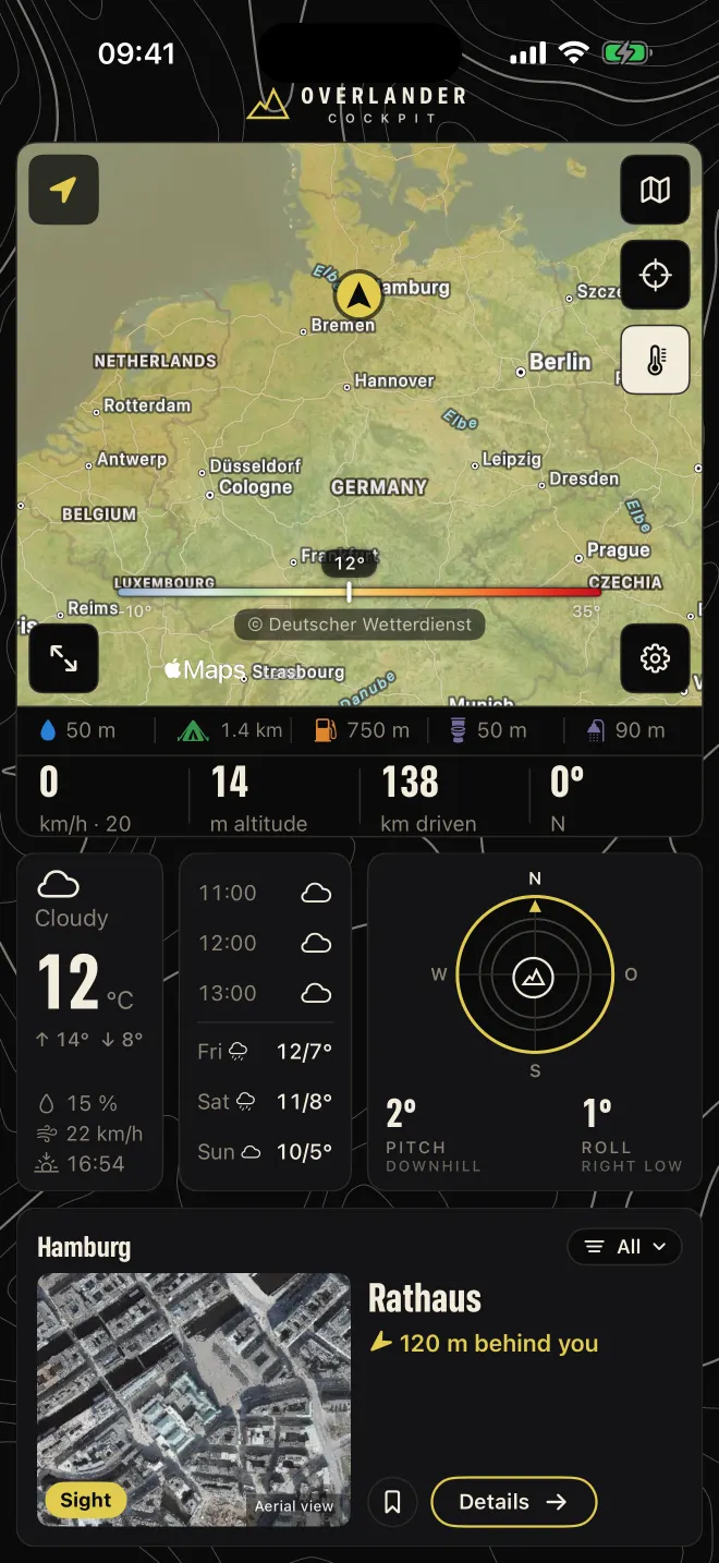
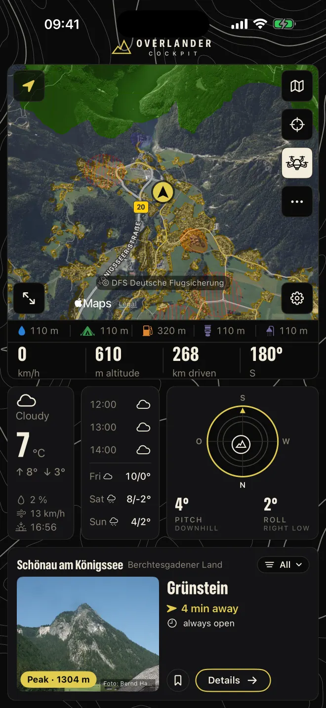
One drive, three places.
From the fjord over the pass to the end of the E10. This is the cockpit on the road – screens from the app, not mock-ups.
-
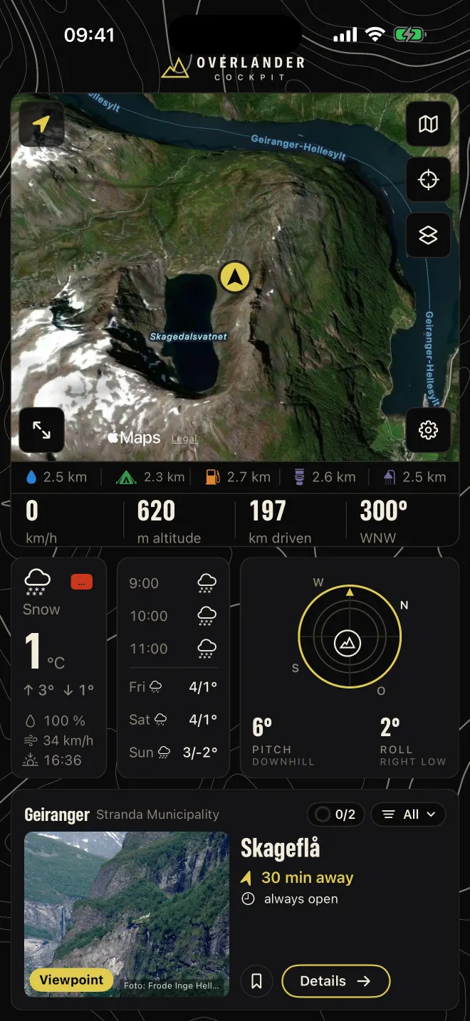
Geirangerfjord, Norway
Snow at one degree, wind at 34 km/h, 6 degrees of tilt. The cockpit shows it all at once – and the bar at the bottom already lists water, camping and fuel nearby.
The attitude tile shows 6 degrees pitch downhill and 2 degrees roll, right side low. Next to it, the forecast: snow until 11 am, 4 to 5 degrees by day from Friday to Sunday. At the bottom, Discover suggests the Geirangerfjord, a UNESCO World Heritage site, 3.4 km straight ahead. 197 km driven, heading west-northwest.
- Elevation
- 620 m
- Weather
- 1 °C, snow
- Camping
- 2.3 km
-
Umbrail Pass, Alps
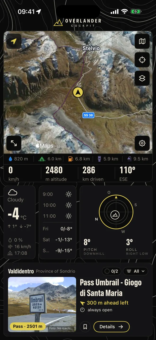
At 2,480 metres there is often no signal. Maps, contour lines and routing were loaded onto the device beforehand and keep working. Attitude shows 8 degrees pitch and 3 degrees roll.
The map shows the terrain in 3D, with the SS 38 pass road down to Stilfs. The weather: cloudy, minus 4 degrees, wind at 18 km/h, down to minus 8 at night and minus 18 in the coming days. Discover reports the summit 300 m ahead on the left, 2,501 m, always open. The nearest water is 820 m away.
- Elevation
- 2,480 m
- Attitude
- 8° pitch, 3° roll
- Signal
- not needed
-
Sørvågen, Lofoten
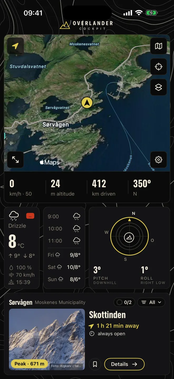
Drizzle, wind at 71 km/h, 412 kilometres driven. The Viking museum is a good hour away – direction and driving time are already on the map.
The vehicle is on the E10 at the edge of the village, speed limit 50 km/h. Water and camping are 1.1 km away each, the nearest toilet 790 m, fuel 5.1 km. The Lofotr Viking Museum is open daily from 10 am to 7 pm, the drive takes 1 h 23 min. For the coming days the forecast stays at drizzle, 7 to 10 degrees.
- Wind
- 71 km/h
- Water
- 1.1 km
- Fuel
- 5.1 km
What the app does.
- Offline maps
- Maps, contour lines and routing for all of Europe, downloaded region by region. Without signal the iPhone calculates the route itself – and recalculates if you take a wrong turn.
- Trip planning
- Set destination and stops, see driving times in advance. For a trip the app downloads the corridor along the route, up to 25 km on each side.
- Navigation
- With signal the server routes with traffic and closures, without signal the device takes over. The bar shows the next water points, campsites and fuel stations along the route.
- Attitude & tilt
- Pitch and roll of your vehicle at a glance, with a warning before it gets critical. Plus elevation and heading.
- Weather & discover
- Weather and warnings for your location, hours and days ahead. Next to it, sights with direction and driving time, calculated as a detour while navigating.
- GPX & recording
- Load GPX tracks and follow them, record your own drives and share them as GPX.
- iPhone and iPad together
- The iPhone sends its position via Bluetooth to a Wi-Fi iPad. The map large on the iPad, attitude and weather on the iPhone.
- Offline first
- What has been loaded stays: maps, places and the last loaded weather, even without signal.
What stays free, what Pro costs.
The app is free. For the first 14 days everything is unlocked – no subscription, no purchase prompts.
Stays free
- Map with your location
- Attitude & tilt with warning
- Weather and warnings
- Place search and places nearby
- Maps already downloaded
With Pro
- Navigation online and offline
- Trip planning with stops
- Offline regions: maps, contour lines, routing
- Map layers such as rain, wind and drone zones
- Follow GPX, record drives
- €4.99per month, for a single trip
- €19.99per year
- €69.99one-time, forever
Prices incl. VAT, purchased through the App Store with your Apple ID. No account with us needed.
Frequently asked questions.
Does the app work without any signal?
Yes, for everything you downloaded beforehand: maps, contour lines, routing and places. Rain radar and current weather need signal; the last loaded weather stays visible.
Do I need an account?
No. The app works without sign-in. Purchases go through your Apple ID.
Which countries are covered?
All of Europe, downloadable region by region.
Does the app run on an iPad without GPS?
Yes. An iPhone with Overlander sends its position to the iPad via Bluetooth.